- Home
- Who We Are
- Products
-
Brands
-
Products by Measure
- Vibration Analyzers
- Peristaltic Pumps
- Airflow
- CO Carbon Monoxide
- Geiger counters
- Destiladores
- Spectrophotometry
- Sterilization
- Fluorescence
- GEOTECHNICS
- Soil Moisture
- Leaf area index
- Rain Gauge
- Meteorology
- Water Level
- O2 Oxygen
- pH
- Differential Pressure
- Radiation
- Salinity/Conductivity
- Telemetry
- Air Speed
- Relative Humidity
- Veterinary
- FUEL CELL HARDWARE
- Network Analyzers
- Calibrators
- WATER FLOW
- Color / Colorimeter
- Particle Counters
- Wind Direction
- Spectrometry
- Evapotranspiration
- Photosynthesis
- Cracks in Buildings
- Pipes Inspection
- Quantum Light
- Movement & GPS
- Diesel Level
- Oxígeno Disuelto DO
- Atmospheric Pressure
- Radon
- Sap/Sap Flow
- Temperature
- AIR QUALITY
- Ammonia
- Chlorophyll
- Conductivity in Soil
- Dendrometers
- Electrochemistry
- Spectroradiometry
- Pharmacy & Medicine
- GAS (ANALYZERS)
- Leaf Wetness
- Idc (DC Current)
- KW & KW/H
- PAR Light
- Nitrate
- Occupation and Time
- Particle Meters
- Soil Water Potential
- Pulses
- Flavor/Taste/Acidity
- Sodium
- Turbidity
- VOC
GEOEXPLORER-SW GeoExplorer geotechnical integration and analysis software
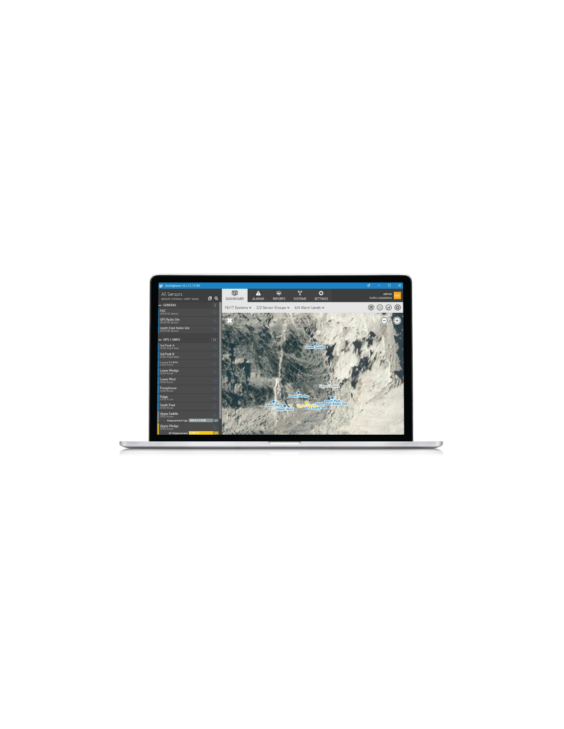
All-in-one software platform to integrate, manage, visualize, and analyze geotechnical, geospatial, and IIoT monitoring data within a single environment.
GEOEXPLORER-SW GeoExplorer geotechnical integration and analysis software
I accept privacy policy rules
Overview
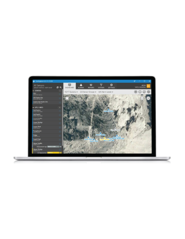
GeoExplorer by NavStar is a comprehensive software solution designed for the integration, management, visualization, and analysis of sensor data in geotechnical monitoring projects. The platform unifies data from in-ground, IIoT, and geospatial monitoring systems within a user-centric interface to simplify interpretation and decision-making.
The system changes how monitoring data is handled by combining a wide variety of sensors and data types into a single operational environment. Its ability to correlate diverse datasets, such as ground displacement and pore pressure, provides a holistic understanding of site conditions and helps optimize resources and project outcomes.
Operational functions
- Complete integration of sensor, geospatial, and IIoT monitoring data.
- Centralized management of monitoring information.
- Advanced visualization and unified analysis in one platform.
- Correlation across different datasets to improve understanding of ground and structural behavior.
- Real-time or near real-time deformation telemetry to improve safety and response capability.
Application focus
GeoExplorer is intended for projects that need to supervise large numbers of points while combining measurements of different kinds. Orica highlights its use in mining, construction, and quarrying geotechnical monitoring workflows, supporting more efficient engineering operations.
Within the Total Stations & Prisms Module, the platform is designed to monitor well-defined areas such as mine highwalls by integrating total stations and prisms into the GeoExplorer analysis environment.
Product features
- All-in-one software solution for data integration, management, visualization, and analysis.
- Unified platform for in-ground, IIoT, and geospatial monitoring systems.
- Correlation of datasets such as ground displacement and pore pressure.
- Real-time or near real-time deformation telemetry.
Highlighted modules and functions
- Total Stations & Prisms Module.
- GPS & GNSS Module.
- InSAR Module.
- Wireline Extensometers Module.
- In-Place Inclinometers Module.
- Tilt Meters Module.
- Piezometers Module.
- Weather Module.
- Webcam Module.
- Radar Module.
Application sectors
- Surface coal.
- Surface metal.
- Iron ore.
- Construction.
- Quarrying.