Carrinho de compras


.jpg)


Vantagens:
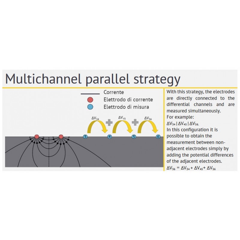
► Paralelização de medições para as configurações pólo-dipolo, pólo-pólo, dipolo-dipolo e tridimensional
► Resolução de 24 bits
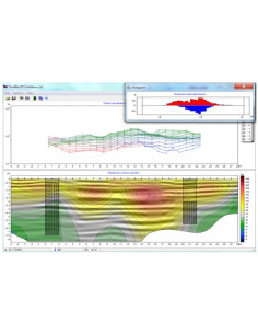
► Pseudosecção em tempo real
► Permite levantamentos VES e tomográficos.
Vantagens da arquitetura de aquisição de dados MAE ET300:
- Reduza drasticamente o tempo necessário para completar uma pesquisa.
- Possibilidade de dar resposta a investigações que anteriormente eram impensáveis, devido ao elevado número de medidas necessárias
- Possibilidade de repetir as medições várias vezes para minimizar a incerteza, durante o mesmo tempo medido
- Menor consumo de energia
- Registo do desvio padrão para cada medição
- Representação gráfica com barras de erro dos pontos de medição
- Visualização em tempo real da pseudosecção de resistividade
- Disponibilidade de função de repetição automática das medições com percentagem de erro superior a um limite configurável.
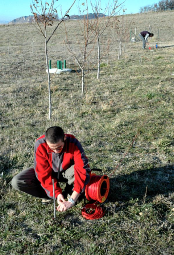
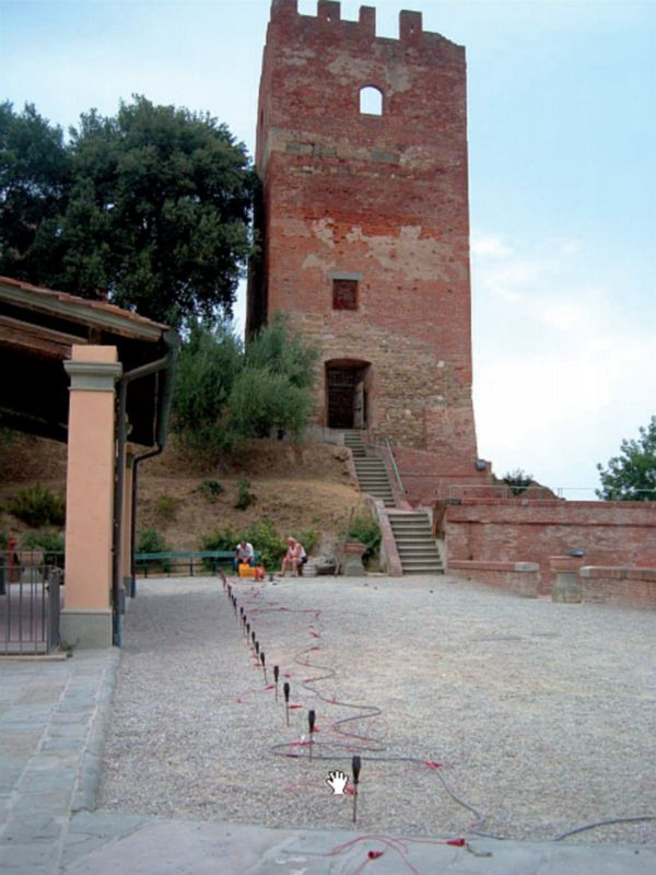
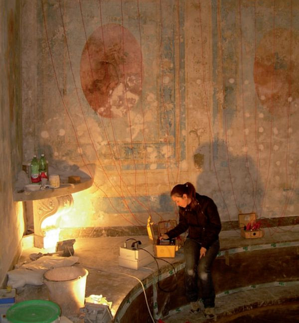
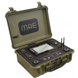
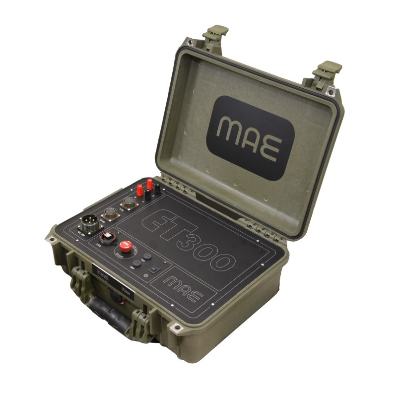
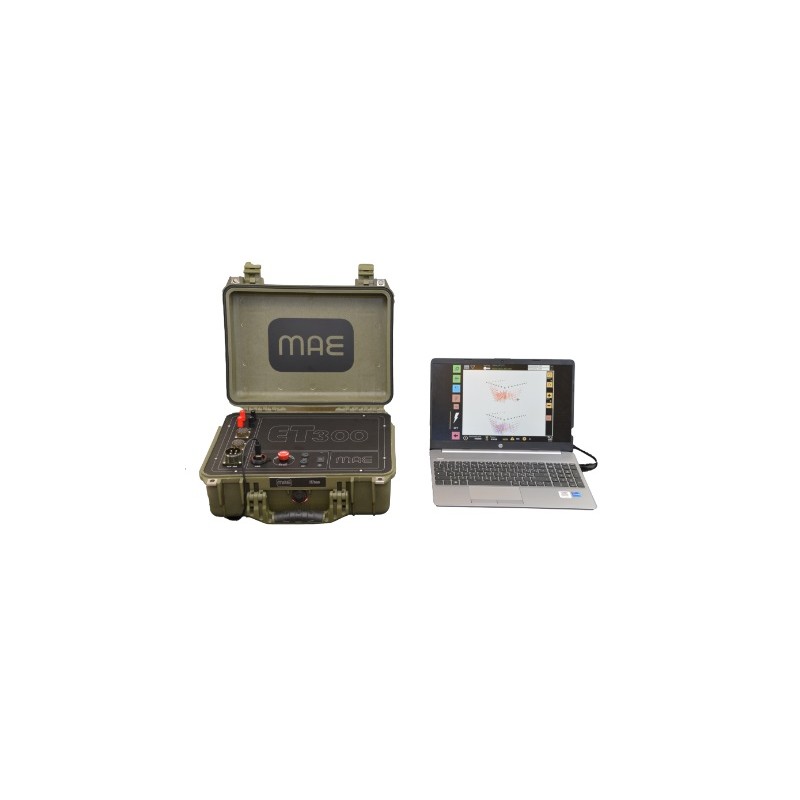
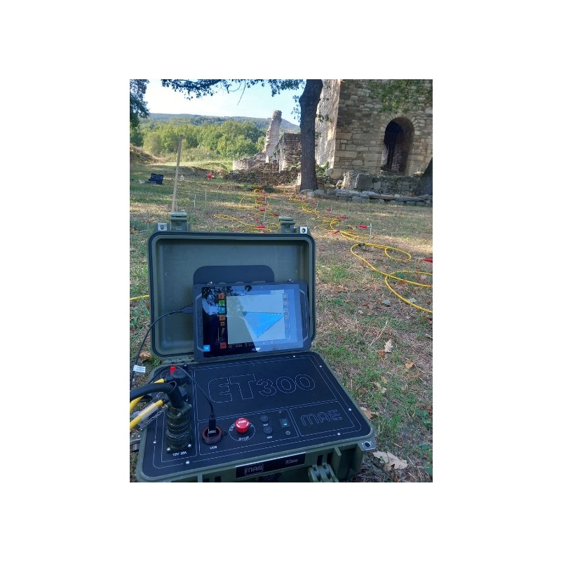
O ET300 é um novo medidor de georresistividade compacto para SEV e prospeção geoelétrica multieletrodo com 24 ou 48 elétrodos.
A principal característica desta instrumentação é a máxima versatilidade de utilização aliada à elevada velocidade de execução de levantamentos, tanto 2D como 3D. O ET300 é gerido através de um portátil ou tablet normal através de ligação USB.
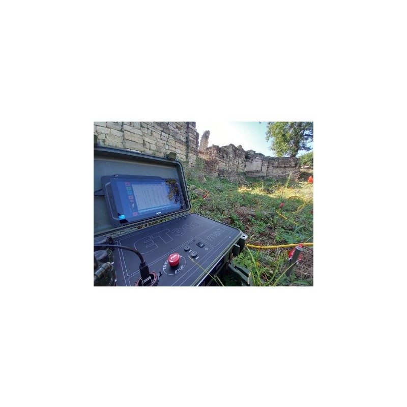
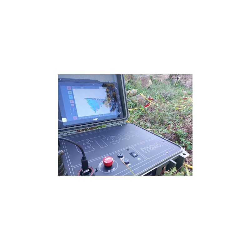
Está equipado com a função "preview" que permite ao utilizador visualizar uma pré-visualização da pseudosecção derivada do comboio de dados recentemente adquirido diretamente no terreno.
A instrumentação realiza a medição ou o ciclo de medição definido pelo utilizador em modo automático.
Uma vez concluído o ciclo de medição, os dados adquiridos podem ser imediatamente visualizados através da função "preview", cuja utilização permite ao operador verificar imediatamente os dados registados e processá-los com o respectivo software de processamento de dados.
Em geral:
Tecnologia ADC: ADC Delta-Sigma de 24 bits
Número de elétrodos: 24-48 (com 20 canais)
Configurações da matriz: 1D, 2D, 3D
Medições: Autopotencial, resistividade, polarização induzida
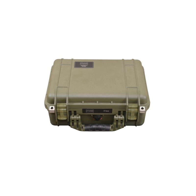
Dimensão: 40x33x17cm
Peso: 6,3kg
Compatibilidade de exportação: RESinv, ERTlab, ZondRES, MAE
Função roll-along: controlada por software
Pseudosecção em tempo real: 1D, 2D e 3D
Gerador de sequências: 1D, 2D e 3D
Caso: IP67
Condição ambiental: -20°C/90°C
Fonte de alimentação: Bateria externa de 12V, sugerida 100Ah
Consumo médio: 0,5A, pico até 50A
Saída:
Potência de saída: 300 W
Tensão de saída: ±50V, ±100V, ±200V, ±400V, ±800V
Corrente de saída: até 6A a 50V, até 0,375A a 800V
Diagrama de energização: Personalizado a partir dos 250ms
Precisão: ±0,2 μA
Precisão: <0,2%
Entrada:
Estratégia de medições: Paralela
Tensão de entrada: ±25V
Precisão: 1,5 μV vs escala completa
Precisão: <0,2%
Impedância de entrada: 2,5MΩ
Empilhamento e redução de ruído: Até 255
Filtro de entalhe de entrada: 50 Hz
Ajuste de auto potencial: Automático
Janelas IP: Até 20 janelas num intervalo de 20ms
Multi-electrode Geoelectrical Prospecting+
V.E.S. Vertical Electrical Survey+
Induced Polarization Measurement+
Spontaneous Potential Measurement+
.jpg)


